Finally...A Town I Can Pronounce-Saturday, August 27th
Glorious day. Fine weather, beautiful scenery, and...there was a hint of a tailwind all afternoon. This stretch of road is pretty flat with just a couple of 10-12% hills before Vik, where I ended my day.
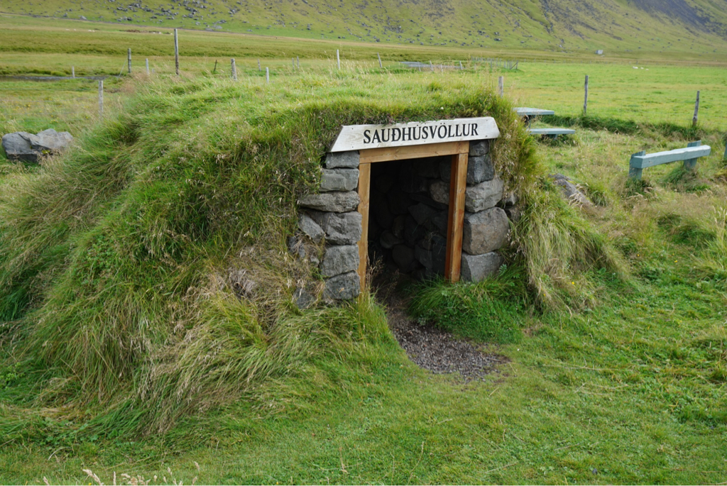
I stopped at a little structure called "the shed". Farmers built and used these to hold their cans of milk for pickup, and once in awhile, a traveler would take refuge in one. With the modernization of milking, tanks installed at the farm make these little sheds obsolete, but some would tell you that elves still exist and inhabit the sheds. And the elves need to be respected.
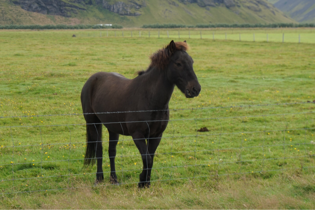
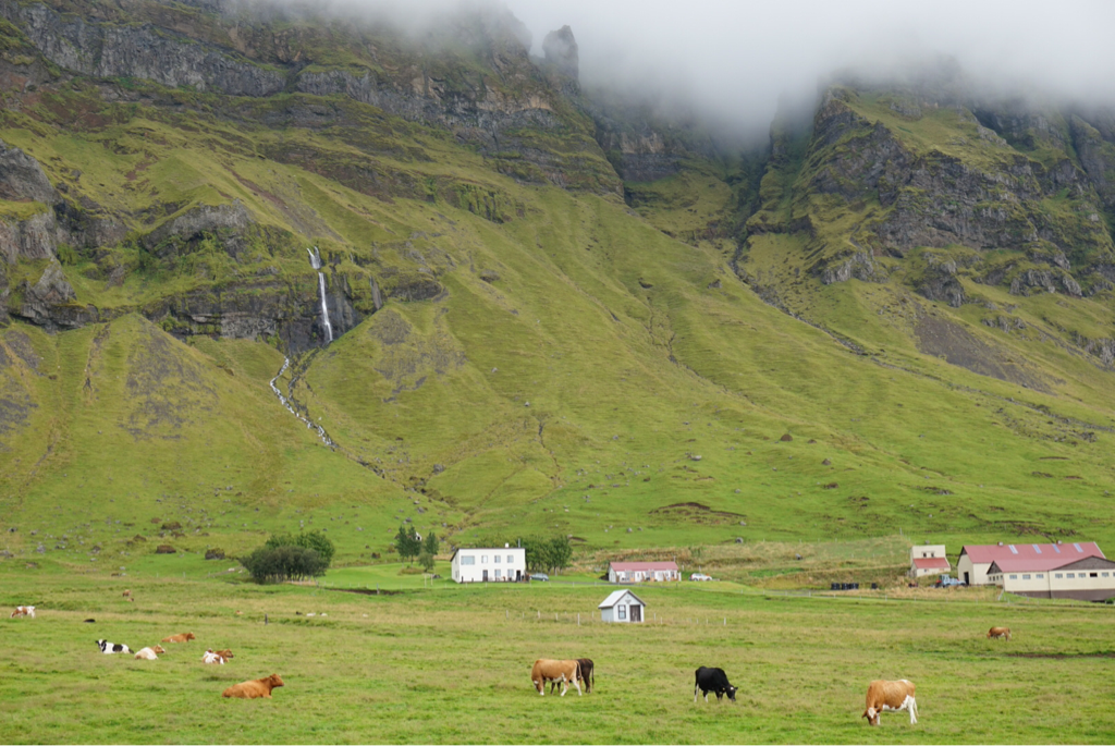
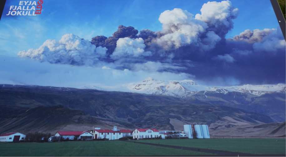
I passed a lot of farms...horses, cows, sheep...one in particular caught my eye. It sits at the base of Eyjafjallojökull and is called Porvaldseyri. The glacier topped Eyjafjallojökull erupted in 2010, but this farm has been in the family since the early 1900's. The Porvaldseyri farm residents have transformed part of the farm into a visitor's center, to inform visitors of the 2010 eruption. Though it was relatively small, air travel was disrupted and farmers had major problems when a thick layer of ash covered every square inch of their grazing land.
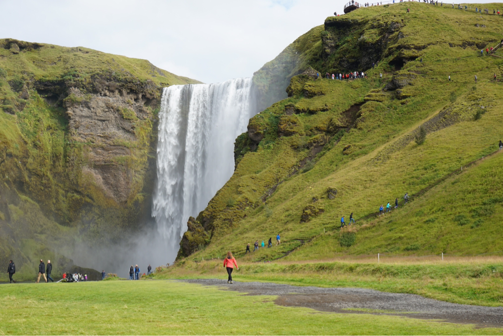
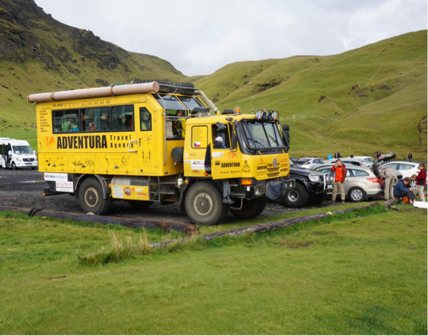
Skogafoss was beautiful. I love how Iceland combines a lovely waterfall, hiking trails, and a campground. OH, and let's not forget the tourist and adventure busses.
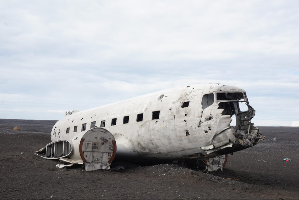
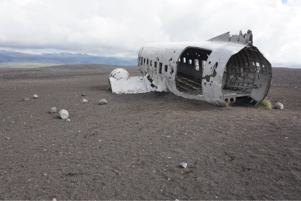
I kept heading towards Vik and soon came upon some people, a LOT of people who were walking with cameras in hand. They were walking towards the coast, but where were they going? Puffins?!? The coast was a long ways away...maybe 3 or 4 miles...so...I rode. I kept passing people on the black, sandy trail, wondering..."What is out here?" And then I remembered from some travel blogs...in 1973, a Navy plane ran out of fuel and crash landed here on the black sands beach at Sólheimasandur. Everyone survived. The really weird thing was that later they found out that the pilot had mistakenly switched on the wrong fuel tank. Lost...anyone?
I spoke with a couple of young Norwegian backpackers at the intersection of Highway 1 and the road to Dyrhólaey. No puffins. I opted to head on to Reynisfjara. Oh...and those cute Norwegians have no confidence that they'll be picked up...c'mon drivers, pick 'em up!
I spoke with a couple of young Norwegian backpackers at the intersection of Highway 1 and the road to Dyrhólaey. No puffins. I opted to head on to Reynisfjara. Oh...and those cute Norwegians have no confidence that they'll be picked up...c'mon drivers, pick 'em up!
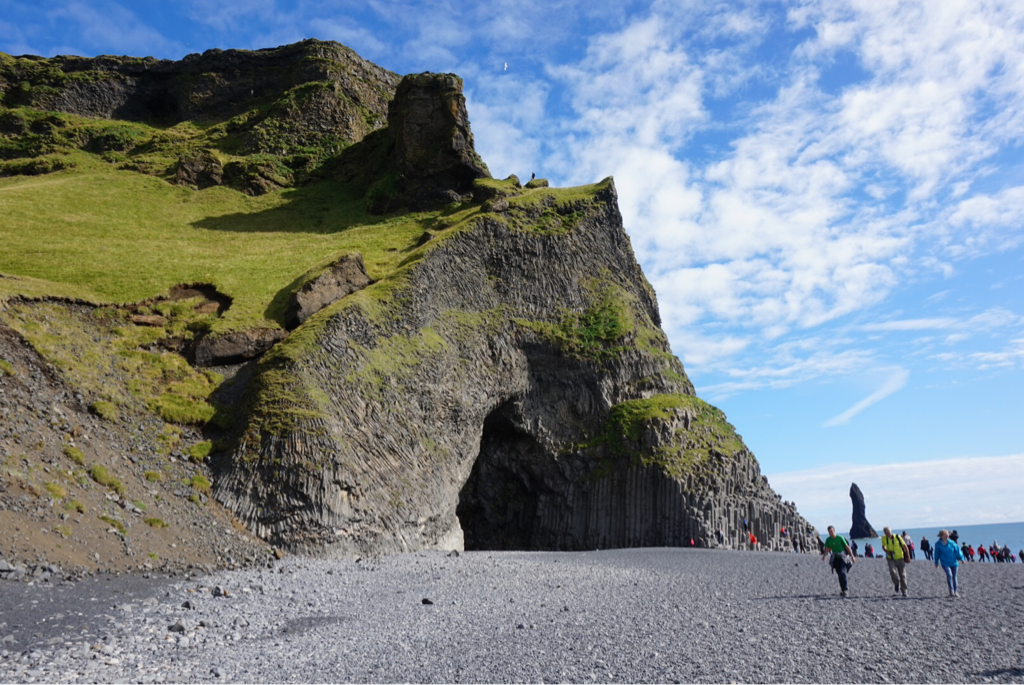
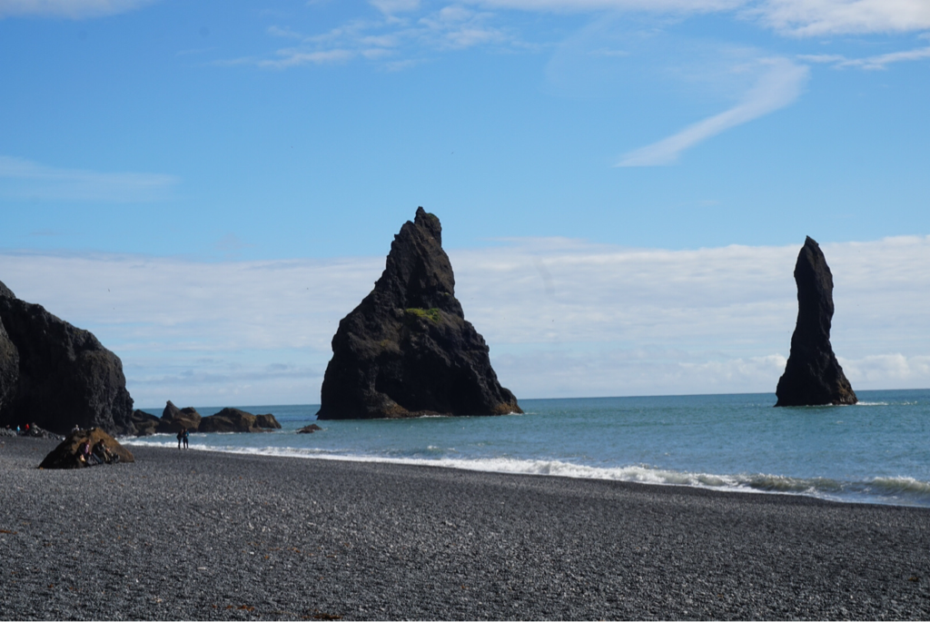
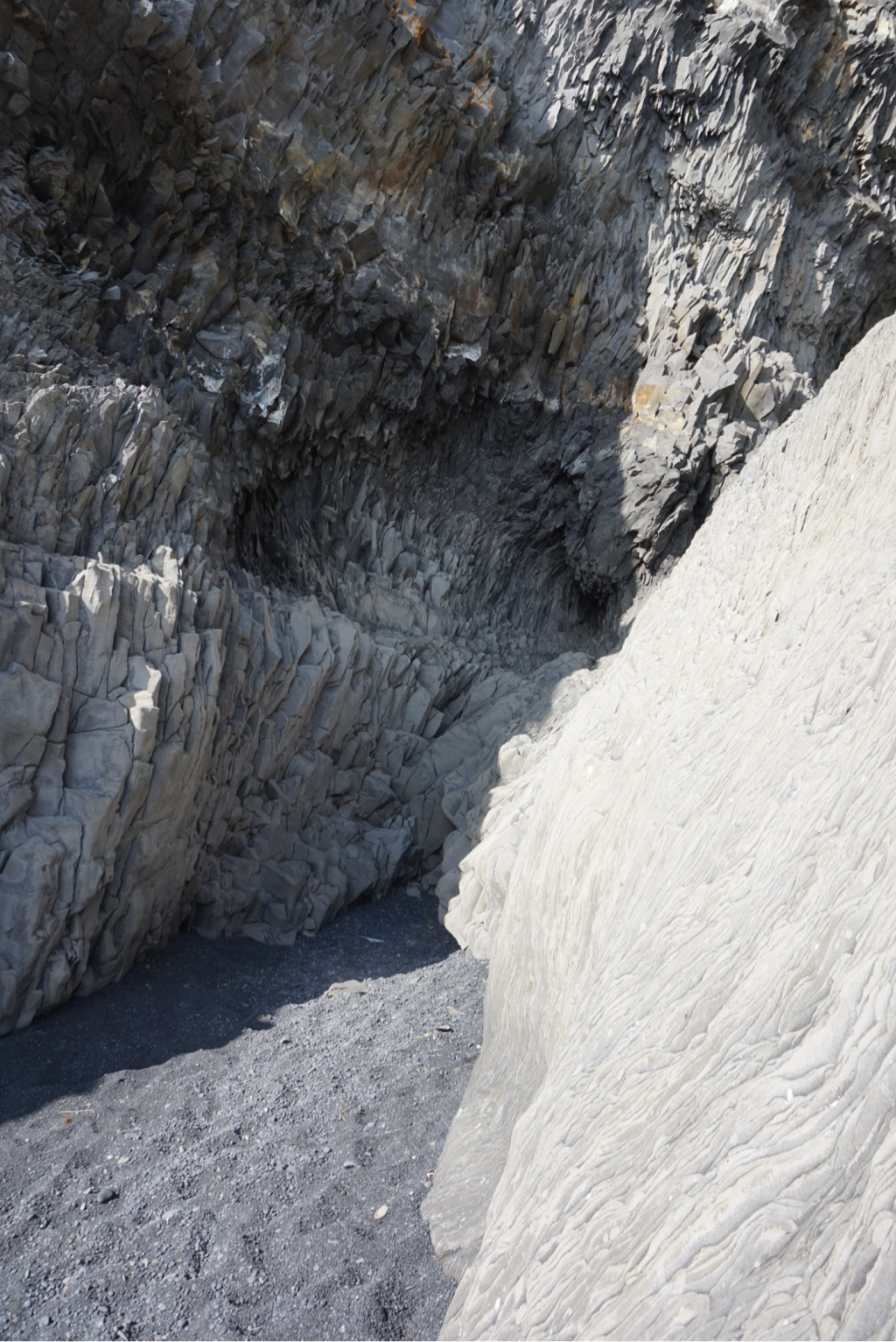
The most scenic part of my day? Reynisfjara. It's about 4 or 5 miles off Highway 1, but the beach and rock are beautiful. Basalt columns (Reynisdranger) form high cliffs which come right down to the beach, and there are also rock formations out in the sea. Legend holds that two giants tried to pull a three-masted ship to shore, but got caught by the sunrise, and all three were turned to stone.
Another nice campground here in Vik. I have done my laundry, had my dinner (I'm afraid I have adopted the way of the 20-something backpackers and started to make tea and cook a little pot of rice or soup in the community kitchen.)
Another nice campground here in Vik. I have done my laundry, had my dinner (I'm afraid I have adopted the way of the 20-something backpackers and started to make tea and cook a little pot of rice or soup in the community kitchen.)
